
How to Find Climbs Near You With Stiip
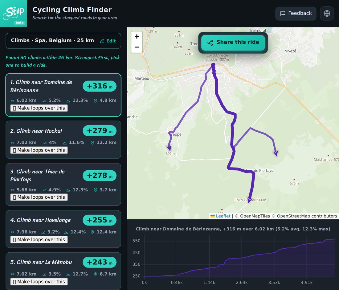
There are good climbs near you that you've never ridden. Stiip's climb finder shows them on a map, ranked by how much they climb. Here's how to use it.
Step 1 — Drop a point and pick a radius
- Type a place — or tap the map where you want to search.
- Set a search radius, in km.
- Let Stiip scout.
In a moment you'll see something like "Found 60 climbs within 25 km."
Step 2 — Read the list
Climbs are ranked biggest first. Each card tells you:
- +metres — how much the climb goes up.
- length and average % — how long and how steep.
- max % — the nastiest ramp.
- distance away — how far the climb is from your point.
Steep and short, or long and steady? It's all there at a glance.
Step 3 — Build a ride around it
Found a climb you like? Tap Make loops over this. Stiip builds a whole hilly ride that takes in that climb — then you can download the GPX or send it to your GPS.
Quick tips
- Search where you'll start, not the town centre — you'll get climbs you can actually reach.
- Widen the radius for a bigger day; keep it tight for a quick evening ride.
- Don't just take the top one. A slightly easier climb on a quieter road often makes the better ride.
Drop a point, pick a climb, go ride it.